? How do archaeologists locate excavation sites

Archeology is the study of the human past using material remains left by ancient people. Archeology uses artifacts and features to learn how people lived in their times and places. They want to know what the daily life of these people was like, how they were ruled, how they interacted with each other, what they believed and valued...about the origin of the word archaeologist and the surveying processes...and the modern techniques used...and how the archaeologist determines the sites of excavations...the following report is about
"Archaeologist" is a Greek word that means...ancient

Scientific sampling to determine where to dig
The word “archaeology” comes from the Greek word “arkhaios,” which means “ancient.” Although some archaeologists study living cultures, most archaeologists are interested in the distant past.
Archeology is based on the scientific method. Archaeologists ask questions and develop hypotheses. They use evidence to choose a dig site, then use scientific sampling techniques to determine where to dig on the site. They observe, record, classify and interpret what they find. They then share their findings with other scientists and the general public.
In an article published by the Australian website “The Conversation”, archaeologists Gabriel De Roble and Stacey Camp say that discovering antiquities may sometimes be an easy matter, such as passing by a prominent site, or it may be a complex task that requires the use of lasers and satellite images. Industrial and other new geophysical techniques to uncover long-lost archaeological structures.
Scans

Operations to search for the presence of human activity with a trained eye
The authors stress that high skills and advanced tools help researchers locate traces of ancient times, which was not available to scientists a few decades ago.
During the quarantine that the world witnessed in 2020 due to the Corona pandemic, modern technology allowed many archaeologists and volunteers to draw maps of ancient roads and settlements that were not known before.
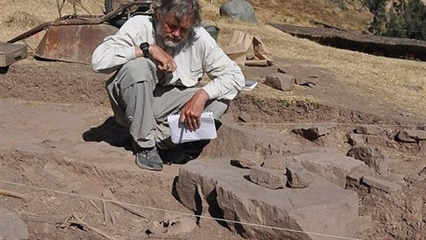
The authors state that the simplest and oldest method of identifying antiquities is survey operations, that is, searching for evidence of the presence of human activity either through unorganized exploration tours, or walking along specific road networks, and unless the evidence is completely clear - such as the remains of broken pots - it usually requires operations Scanning to a trained eye to read the evidence.
The authors add that understanding this evidence may require familiarity with geology and knowledge of the nature of the plants in the research area, and archaeologists usually seek help from local residents who know their areas well in their search operations.
Modern techniques

Using new methods to discover archaeological sites
The authors say that in recent years, archaeologists have begun to use new methods to discover archaeological sites that were not previously discovered.
These technologies have become widely known as remote sensing technology, and they allow dense forests to be digitally surveyed and soil imaged in a way that reveals everything that lies beneath, and high-resolution scans using lasers or 3D images can discover everything that the human eye does not see.
For example, lidar technology launches pulsed laser beams to determine the distance based on the pulses reflected from the target and the speed of the reflection. When used from an aircraft, this technology draws us a detailed topographical map of the place, revealing everything that the earth contains.
A recent example of scientists benefiting from this technology is the discovery of the ancient city of Tikal in the rainforests of Guatemala. Archaeologists were previously unable to reach this site despite the surveys they conducted several times.
Satellite images - including Google Earth - also help lead to new archaeological sites, and the recent drought in England has led to the emergence of ancient landmarks monitored by satellite images.
The authors add that scientists also use geophysical techniques that help them survey the land that is likely to contain traces, as this helps them reach the intended location directly by distinguishing the density of the soil or its magnetic properties.
Discoveries from home

A group of archaeological discoveries
In her report published by the British newspaper The Independent, writer Jane Dalton said that many archaeologists who spend the quarantine period at home; Due to the outbreak of the new Corona virus, they discovered dozens of unregistered sites dating back to the Roman era, prehistoric era, or the Middle Ages.
The writer stated that the team found parts of two Roman roads, about 30 large fortified settlement facilities dating back to the prehistoric or Roman era, and 20 prehistoric corpses, and they also identified the remains of hundreds of medieval farms, field systems and quarries.
Project supervisors say they expect to make more discoveries in the coming weeks.
The team, based in Devon, England, analyzes images derived from LiDAR, a technique for measuring distances by illuminating a target with laser light and measuring reflectivity with a sensor.
Lidar technology is being used during aerial surveys to produce highly detailed topographical maps.

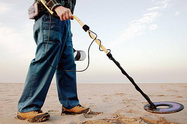
A device for detecting ancient artifacts
The author pointed out that this technique enables plants, trees, and modern buildings to be excluded from the image, allowing archaeologists to look at the shape of the Earth's surface to find the remains of ancient excavation work.
Currently, the data uncovered is being examined and compared with known archaeological records and historical maps, contributing to the constantly changing collection of new finds.
According to project leader Dr Chris Smart from the University of Exeter, “The south-west of Britain arguably contains the most comprehensive lidar data currently available in the UK, used to map as much of the historical environment as possible.”
Smart added: “The project currently focuses on the Tamar Valley, but has been expanded to include a large area of land between Bodmin Moor and Dartmoor, Plymouth and Barnstaple, which amounts to about 4,000 square kilometres.”
Source: websites

