NASA unveils never-before-seen map showing where ice is hidden on Mars

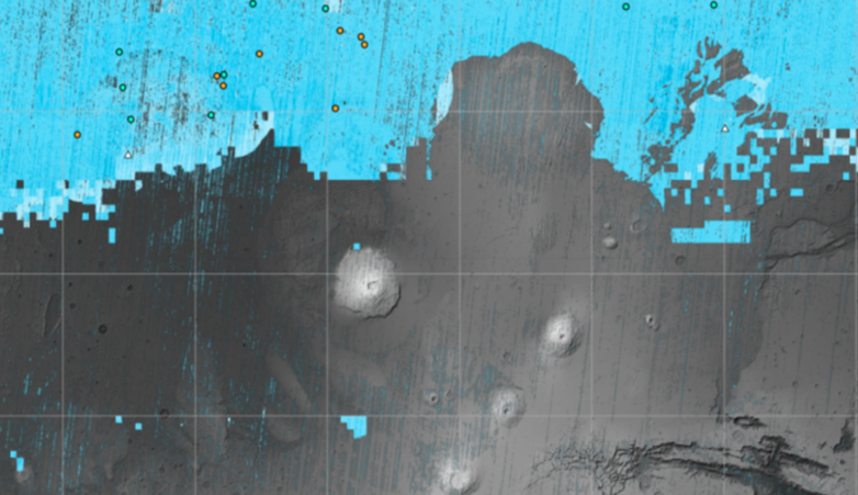
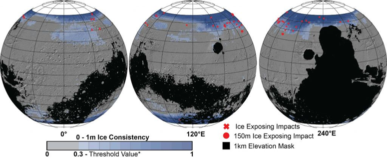
This new map of the planet Mars shows the regions where groundwater ice has been found during Martian missions. In particular, it will allow future manned missions to define the best location for landing.
On this new map of the planet Mars, the blue color indicates areas where ice has been detected by previous missions. It was carried out by NASA's Subsurface Water Ice Mapping project (SWIM).
The main objective of this card is to allow future astronauts to access drinking water reserves, particularly for consumption or to produce fuel. Indeed, water will be an essential resource for future manned missions and the possibility of extracting it on site will reduce the quantity necessary to transport from Earth. (You can view an interactive version of this map at this link).

Above all, accessing the ice reserves will be an opportunity to study the climatic history of the planet and its possible past microbial life, as well as to assess the possibility that it will harbor microbial life in the future.
The best landing location on Mars for future astronauts
By mapping the availability of subsurface ice, SWIM project scientists were able to determine that the most optimal landing sites are located at the southern end of the mid-latitudes.
Future equipped missions will need to take care to take astronauts to the warmest regions possible, while aiming for regions where there is water ice available. “If we send humans to Mars, we must place them as close to the equator as possible. The less energy you have to spend to keep the astronauts and their equipment warm, the more you will have for other things they will need,” said Sydney Do, NASA SWIM project manager. Indeed, even if the polar regions are rich in ice deposits, the extremely cold temperatures make long missions impossible, whether for astronauts or even for robots.

This location still has the advantage of being covered by a thicker atmosphere than other regions of the Red Planet. The Martian atmosphere is actually so thin that this is why water is not stable on the surface, but evaporates immediately. The fact that this region has a thicker atmosphere makes it easier for a spacecraft to slow down when landing.
The map was produced using data provided by the 2001 Mars Odyssey and Mars Global Surveyor missions and particularly by the Context Camera (CTX) and High Resolution Imaging Experiment (HiRISE), instruments on board the Mars Reconnaissance Orbiter (MRO) mission. This is the fourth map produced by this project and the most detailed to date.
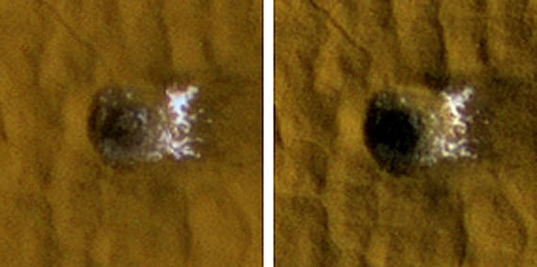
The HiRISE instrument notably revealed in 2022 ice emerging in new craters made by meteorites. “These revealing ice impacts are a valuable form of ground truth, because they show us places where the presence of subsurface ice is unequivocal,” said SWIM co-lead Gareth Morgan.
The new map of underground ice reserves is proving to be a key resource for upcoming manned Martian missions. In addition to providing valuable information on the ideal latitude for landfall, it could help analyze why there are variations in the amount of underground ice at the same latitudes, which is still a mystery to scientists. The answer could provide more knowledge about the planet's climate evolution. Again, during underground excavations, it will be possible to verify the precision and proper functioning of the imaging instruments used to map the ice reserves.
Source: websites

