An amazing discovery of a map showing Antarctica before it was actually discovered
One of the most important and strangest archaeological discoveries in human history was designed by the Muslim scientist, commander, sea captain, and geographical painter Piri Reis.
The great surprise that astonished the world occurred in 1929, following the discovery of a rare collection of navigational charts dating back to the sixteenth century, which turned geographical and historical concepts upside down. But it dealt with places that Columbus did not reach!! It included the eastern coasts of the two American continents (North and South), the western coasts of the African continent, and the northern coasts of Antarctica, and the degree of accuracy reached a perfect match between the coasts drawn in the sixteenth century and fixed on those amazing maps, and between the images that were taken by satellites.
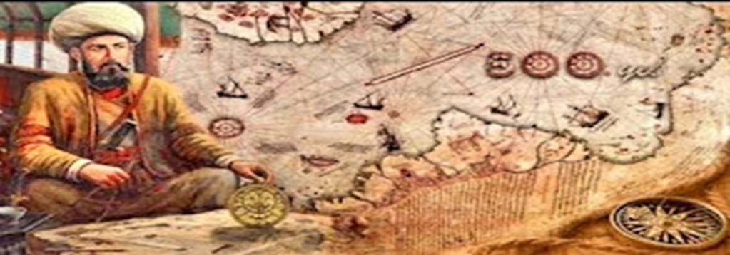
Piri Reis Map:
Piri Reis Map:
Made by cartographer General Piri Reis, this early 15th-century map shows the coasts of South America, Europe, and Africa with surprising accuracy, based on scraps from dozens of other maps.
What is strange, surprising and confusing in this masterpiece is that the map that was discovered in 1513 displays a continent that was not discovered at that time. How could someone in 1513 know about the existence of Antarctica before it was actually discovered, is very interesting.
In 1929, a rolled-up map was found on a dusty shelf in a library in the Topkapi Palace in Constantinople (present-day Istanbul), Turkey. It dates back to 1513.
This map, now known as the Piri Reis Map, was drawn by Muhyiddin Piri (also known as Piri Reis); Admiral in the Turkish Navy, he was a good cartographer and he is one of the world's geographic flags, and one of the most important Muslim sailors who carried the banner of sea jihad.
Surprisingly, Muhyiddin Berry drew a map of the Americas before its discovery by Christopher Columbus himself, and thus some attribute that discovery to him due to his accurate maps and the topography of that unknown continent.
The map of Piri Reis was drawn on parchment of parchment. The map measures approximately 35 by 24 inches. It is currently in pieces, but the surviving parts show different parts of the world as it appeared to cartographers in 1513 AD. It is based on about 20 other maps, Some of them were drawn by Christopher Columbus.
What is most noticeable in the Piri Reis map is that it shows Antarctica, that continent that was discovered in 1818, about 300 years before the discovery of the continent.
The map is currently in the Topkapi Palace library in Istanbul and is considered a puzzle. It bears a drawing of the coasts of West Africa and the eastern coast of South America, which was discovered 300 years after the death of Reis himself.
In addition to part of the northern coast of Antarctica. Moreover, the map shows this polar part of the world without ice covering it.
The latter can be seen at the bottom of the Piri Reis map. How someone in 1513 could have known about the existence of Antarctica is very interesting.
The solution may lie in Piri Reis himself. According to him, the Piri Reis map was compiled from a large number of old maps. Among them is a map drawn by Christopher Columbus, four Portuguese maps, an Arab map of India, eight maps drawn during the reign of Alexander the Great in 332 BC, and six maps from unknown sources.
Piri Reis Maps
According to author Graham Hancock, the real mystery of the 1513 map lies not in its inclusion of a continent not discovered until 1818 (Antarctica) but in its depiction of a portion of that continent's coast under ice-free conditions that reached 6,000 years ago and have not been repeated since. .
Today, about 98 percent of Antarctica is covered in ice. The Piri Reis map depicts the northern coast of Antarctica, when it was not covered in ice.
Some geologists have estimated that the last time parts of Antarctica were free of ice could have been between 17,000 and 12,000 years ago.
Could the Piri Reis map, as some people like Graham Hancock have suggested, be evidence of a ?prehistoric marine civilization that was capable of surveying the entire world
The real mystery of the 1513 map lies not in its inclusion of a continent not discovered until 1818 (Antarctica) but in its depiction of part of the coast of that continent under the ice..."
The mysterious Piri Reis map may show the way to Antarctica before it was officially discovered
In 1773, explorer James Cook passed through the Antarctic Circle for the first time. Cook and his crew discovered land that until then had remained a mystery. While this expedition remains the official "first discovery" of the continent, a map discovered in 1929 indicates otherwise.
The chart was originally discovered in Istanbul, Turkey. While German theologian Gustav Dismann was cataloging the contents of the library of Tubaki Palace in Istanbul, he and the palace director came across bundles of maps and plans hidden within piles of discarded materials. He soon realized the importance of this discovery and passed it on to an expert.
Side of a map of Piri Reis
Immediately, it was identified as the Piri Reis Map, named after the cartographer Piri Reis, who signed the bottom. But even more interesting is what the map appears to be. Along with the usual land masses, there was another - Antarctica. However, the continent was only discovered 200 years ago, so what was it doing on a map from 1513?
History of Piri Reis Map:
In 1513, the Ottoman Turkish admiral, geographer, and cartographer Piri Reis drew a map of the world as it was known up until that point. Perry claimed in an inscription that the chart was based on about 20 other maps in Portuguese, Spanish and Arabic, including some by Christopher Columbus of the New World.
In 1517, Piri presented the Piri Reis map to the Ottoman Sultan Selim I, along with many other maps and charts. At that point, the Sultan thought it was one of the most complete maps in the world, since it was based on many other schemes.
The Piri Reis map also shows a more interesting one. Along the bottom, the map appears to show the northern coast of Antarctica, however, according to almost all historians, the continent was not discovered until 1733 AD, and most interestingly, the continent is connected to South America and does not appear to be covered in ice.
One historian, Captain Lorenzo W. Burroughs, a US Air Force captain with a background in cartography, claims that the depiction of Antarctica is accurate, and that it looks like the continent before it was covered in ice.
"The Princess Martha Coast of Queen Maud Land, Antarctica," he wrote in a letter, "appears to be really represented in the southern sector of the Piri Reis map." The agreement of the map of Piri Reis with the seismic profile of this region provided by the Norwegian-British-Swedish Expedition of 1949 lays beyond doubt the conclusion that the original source maps must have been made before the present Antarctic ice cap covered the coasts of Queen Maud. Land.”
Source: websites


