Who is the founder of geography? The first to make a map of the world, the Geographical Encyclopedia
He was the first to make a model of the globe and document countries with maps similar to satellite maps. Sherif Al-Idrisi was the most prominent scientist and one of the great geographers in human history.
Al-Idrisi was able to draw maps that were as accurate as the level of satellite images, and his images and maps were used in all the European Renaissance era discoveries.
Al-Idrisi established an independent science that is taught today in schools and universities as a result of his travels in countries to culminate his travels with his contribution to the establishment of the country’s geography, which became one of the sciences of the European renaissance.
?Who is Al-Idrisi
The Arabist movement, including the Baathists and the Salafi-Wahhabi movement, brazenly attributes it to the Hashemites from the descendants of the Exalted God, and this is a slander and obscuration of the facts. If the genetic analyzes have exposed the advocates of the Arab, Phoenician and Canaanite studies in North Africa, and when rational logic and scientific argument are present, then the superstitious people must remain silent or say good. It is a shame to attribute non-Arab scholars or elites to Arabs outside the Arab land. This barren land did not appear on its soil, not even one scholar.
He is Abu Abdullah Muhammad ibn Muhammad al-Idrisi. He was born in the city of Ceuta in the Far Maghreb in 1100 AD and died in 1166 AD. He was called the Sicilian because he made the island of Sicily his home after the fall of the Islamic state.
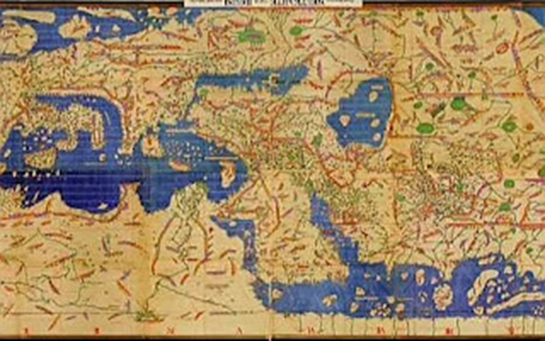
Al-Idrisi map
Al-Idrisi is considered one of the great geographers and travelers in history, and one of the founders of the science of modern geography. He also made contributions in other fields such as literature, poetry, medicine, philosophy, plants and stars. His illustrations and maps were used in all the discoveries of the European Renaissance.
Al-Idrisi excelled in transforming the descriptions of previous travelers into very accurate maps, so he was touring the world without moving from his place. And imagine the sites from just hearing their description.
Al-Idrisi authored the book “Nuzhat al-Mushtaq fi Ikhtiraq al-Afaaq” which is considered his greatest achievement. He called this book “Roger’s Book” in relation to King Roger of Sicily, who asked al-Idrisi to write a book that would be a reference for everyone who wanted to know the earth and what it contained. It took 15 years to complete this book. In it, he described the world as a whole, then divided it into seven regions, then drew separate small maps for each region, then divided each region into ten main sections, describing each section and drawing a map for it. This book remained a reference for geography in the world for more than thirty years.
Al-Idrisi was not satisfied with the book only, but he also made a ball of silver and engraved on it the map of the earth in its details, but this ball was lost in a revolution that took place in Sicily shortly after King Roger, but the book was preserved to be one of the most famous books produced by the Arab-Islamic civilization in the sciences of geography. Europe benefited from this book and took it as a reference.
Al-Idrisi map
Al-Idrisi's maps were more accurate than the maps known before, and this was clearly shown from his maps, as he resorted to determining the directions of the seas, rivers, and heights, explaining the topography of the countries that he drew. To be clear and useful in defining the borders and extensions of countries.
Source: websites


